
These are the ferries which make part of the local transport network in the Riverland. These modern cable ferries operate 24 hours and are free to use to cross over the river as they are a part of the various highways.

In this photo you can see the cables that take the ferry over and back continuously,

Waikerie’s Silo Art.

Amazing the detail.

Waikerie has a cliff top 2km walk with some great lookouts. We didn’t do the walk but drove along some of it and walked out to the viewing areas. All very well done. This is looking up river.

Zoomed in to the cliffs in the above photo.

Now looking down in front of our camp (left bank) and in the same area is where the ferry crosses.

Went along to the next viewing point where we could climb up onto a viewing deck which of cause improved the view. Looking down river and along in front of our camp.

Another photo looking down over the ferry crossing from one bank to the other. There were a couple of viewing points on the walk that we didn’t see so might have a quick stop as we leave town in the morning.

Now down on the area in front of our campsite where all the big houseboats tie up to poles on the river bank.

Some of these houseboats are ones you can hire and self drive along the Murray River. We did this with Joe and Bev in 2009 which was great fun.
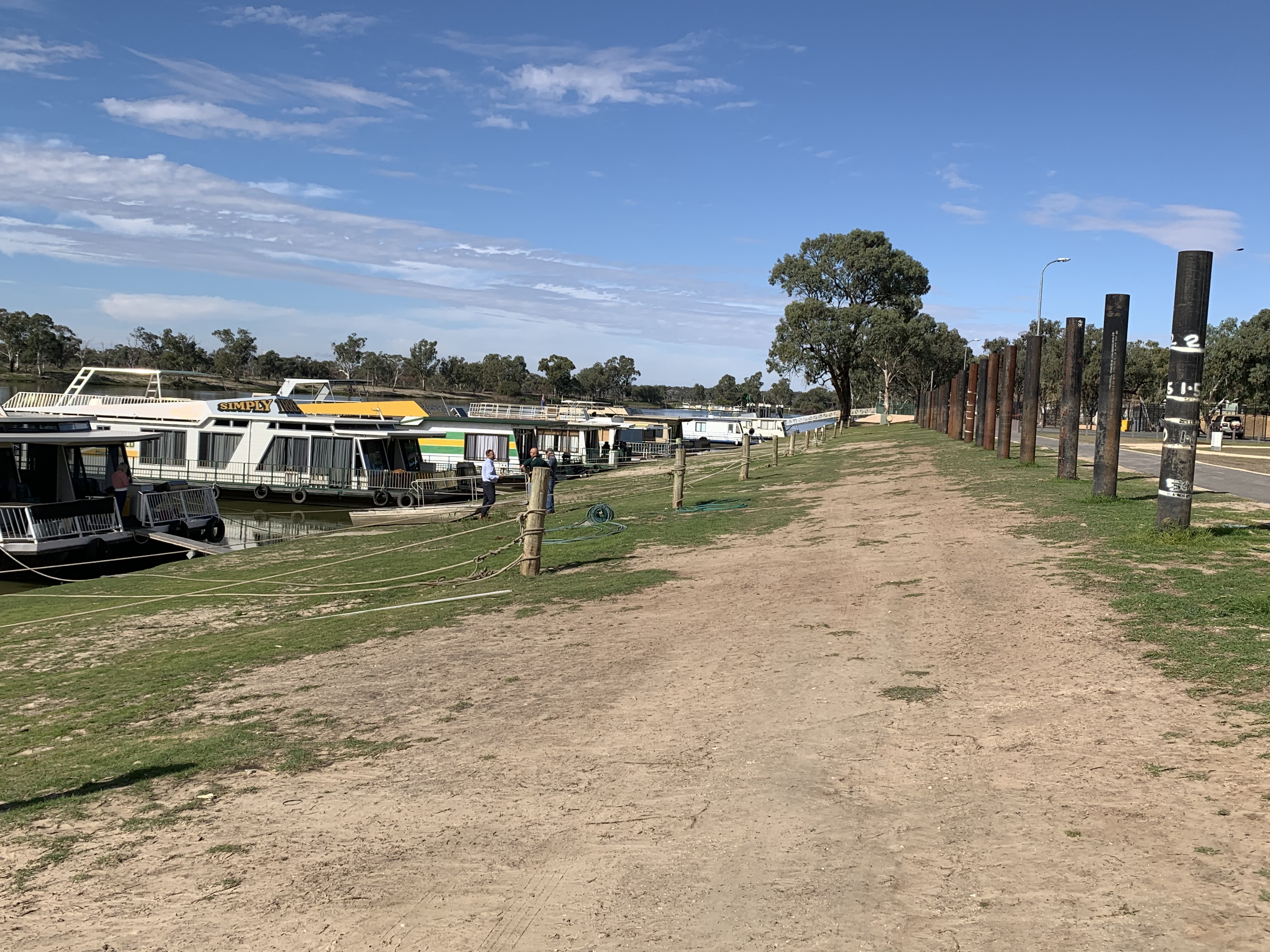
In this photo look at the first black
Pole, on the right of the photo, with the white markings on. When the area had their big floods last year, the white marking is 2metres above the ground where the pole stands (not above the water level). The mark is to show how high up the river went. Although the above photo doesn’t really show how high the banks are, they are steeper than they look. They are still trying to get the grass to grow on the banks after the river washed it all away.

Right along the river banks in this area was once a beautiful reserve. They have been working hard to get it all back up and running again. It’s looking really good now except the grass needs to grow to make it the area it was.

In the same area the grass is coming away. But just imagine it when the river washed all these areas away,

Not sure who this idiot is. Does he look familiar. Still on the reserve area along the the banks of the river.

When the river just kept rising they had to build these huge dykes along the foreshore to keep the rising water back. Our campsite had these right along the front of it which were 2metres high so nobody could see over them to the water. Apparently the water came up to 500cm from the top of the dykes. How lucky were they that it didn’t go over and flood the whole campground out.

This one shows the width of the dykes

The dykes even had to go up the side roads around the camping grounds. They are still working on clearing it all away to get it back to normal.

Looking up the Main Street of the town. That’s our motorhome just under the tree on the right.

It was 6 deg. Over night but reached 22 deg. today very hot no wind. The area certainly traps the sun.

Time to have a cold ginger beer.

This is an aerial shot I found, ( before the floods)looking over part of the caravan park and along the waterfronts grassy reserve. What it used to look like before all the damage. The white van in the park bottom middle of photo, is the site we have. Just across the road from the river. It’s a beautiful grassy park which goes back to the left of the photo.
Tomorrow we follow the river to Mildura for two nights which will take us into Victoria. When we leave there we will then be travelling into NSW. So over four days we will have been in three different states. Also we will move our clocks forward again by 30 minutes.


No comments:
Post a Comment